Tag Archives: crowdsourcing

Industrial Heritage: Software enabled preservation of dispersed and fragile knowledge in miniature.

Developments in software and digital technology have had wide ranging impacts on our leisure time, from movies on demand on our mobiles, internet on public transport and the ‘selfie’  saturated world of social media. Yet advancements in technology have also reached creative activities that are often considered far from mainstream and groups of individuals, who though they share a common interest, may pursue their leisure activity individually and in relative isolation.

One such social group is that of model railway enthusiasts. For these collectors, builders and hobbyists the developments in software have enabled fundamental changes to the way they explore and express their interests.  Geographically dispersed and relatively few in number (estimated in the low hundreds in Ireland) software has offered a means of augmenting the traditional physical locations of interaction, socialising and knowledge sharing. Software and connectivity have enabled a network of online interactions that has linked individuals more closely with the commercial suppliers and the specialist manufacturers of the models they consume, extending the reach of the community beyond the traditional clubs or shows. It has facilitated efficient access to, and the sharing of, previously inaccessible or unknown historic and practical knowledge regarding even the most obscure topics such as window size and seat positions.  Building upon more traditional sources of historic data such as printed media and journals, software has also enabled the capture of dispersed and divergent forms of data and facilitated their transformation, via computerised production methods, into ready-to-run models with unprecedented levels of physical detail and functionality. Continue reading

Oxford Internet Institute Paper: Crowdsourcing: A Geographic Approach to Identifying Policy Opportunities and Challenges Toward Deeper Levels of Public Engagement

Tracey Lauriault presented a paper co-authored with Peter Mooney at the Oxford Internet Institute last week and as promised to those in attendance here are the slides including the references.  The abstract can be read on the The Internet, Policy and Politics Conference website along with many of the other papers and abstracts.

References in order of appearance:
Definitions:
  1. Goodchild, Michael F., and Linna Li. 2012. “Assuring the Quality of Volunteered Geographic Information.” Spatial Statistics 1 (May): 110–20.  doi:10.1016/j.spasta.2012.03.002.
  2. Goodchild, Michael F., 2007, Citizens as sensors: the world of volunteered geography, GeoJournal, 69 (4), pp. 211–221
  3. Conrad, Cathy C., and Krista G. Hilchey. 2011. “A Review of Citizen Science and Community-Based Environmental Monitoring: Issues and Opportunities.” Environmental Monitoring and Assessment 176 (1-4): 273–91. doi:10.1007/s10661-010-1582-5.
  4. Browna, Greg  and Kyttäb, Marketta , 2014, Key issues and research priorities for public participation GIS (PPGIS): A synthesis based on empirical research, Applied Geography, Volume 46, January 2014, Pages 122–136.
  5. Ogiek Peoples visualizing their traditional lands Nessuit, Kenya, Good practices in participatory Mapping (2009), International Fund for  Agricultural Development (IFAD)
  6. Brabham, Daren C., 2013, Using Crowdsourcing In Government. IBM Center for The Business of Government
  7. Google Flu Trends
  8. Mechanical Turk
  9. Notification Edit Service

Typology:

  1. Haklay, Muki. 2013. “Citizen Science and Volunteered Geographic Information: Overview and Typology of Participation.” In Crowdsourcing Geographic Knowledge, edited by Daniel Sui, Sarah Elwood, and Michael Goodchild, 105–22. Springer Netherlands.
  2. Hickling Arthurs Low (HAL), 2012, Volunteered Geographic Information (VGI) Primer, CANADIAN GEOSPATIAL DATA INFRASTRUCTURE INFORMATION PRODUCT 21e, Science & Technology Policy Research and Analysis Resource team, GeoConnections. Ottawa: Natural Resources Canada.
  3. Coleman, D., Georgiadou, Y., & Labonte, J. , 2009, Volunteered Geographic Information: the nature and motivation of produsers. International Journal of Spatial Data Infrastructures Research, Vol 4.

Assemblage:

  1. Kitchin, Rob and Lauriault,Tracey P., 2014, Towards Critical Data Studies: Charting and Unpacking Data Assemblages and Their Work National University of Ireland, Maynooth (NUI Maynooth) – NIRSA National Institure for Regional and Spatial Analysis (NIRSA,
  2. Haklay, M.; Antoniou, V; Basiouka, S; Soden, R; Mooney, P; 2014, Crowdsourced Geographic Information Use in Government. Global Facility for Disaster Reduction & Recovery (GFDRR), World Bank: London, UK.

Examples:

  1. National Biodiversity Data Centre
  2. Coastwatch
  3. Nunaliit Cybercatographic Atlas Framework
  4. Engler, Nate ,Teresa Scassa, and Taylor, D. R. Fraser , 2014, Cybercartography and Volunteered Geographic Information, Chapter 4 in D.R. Fraser Taylor and Tracey P. Lauriault, Developments in the Theory and Practice of Cybercartography, 2nd Edition, Elsevier.
  5. Cybercartographic Atlases
  6. Canadian Geomatics Community Strategy “White Paper” and Scenarios, 2013, prepared for Natural Resources Canada by Hickling Arthurs Low Corporation (HAL).
  7. Programmable City Project

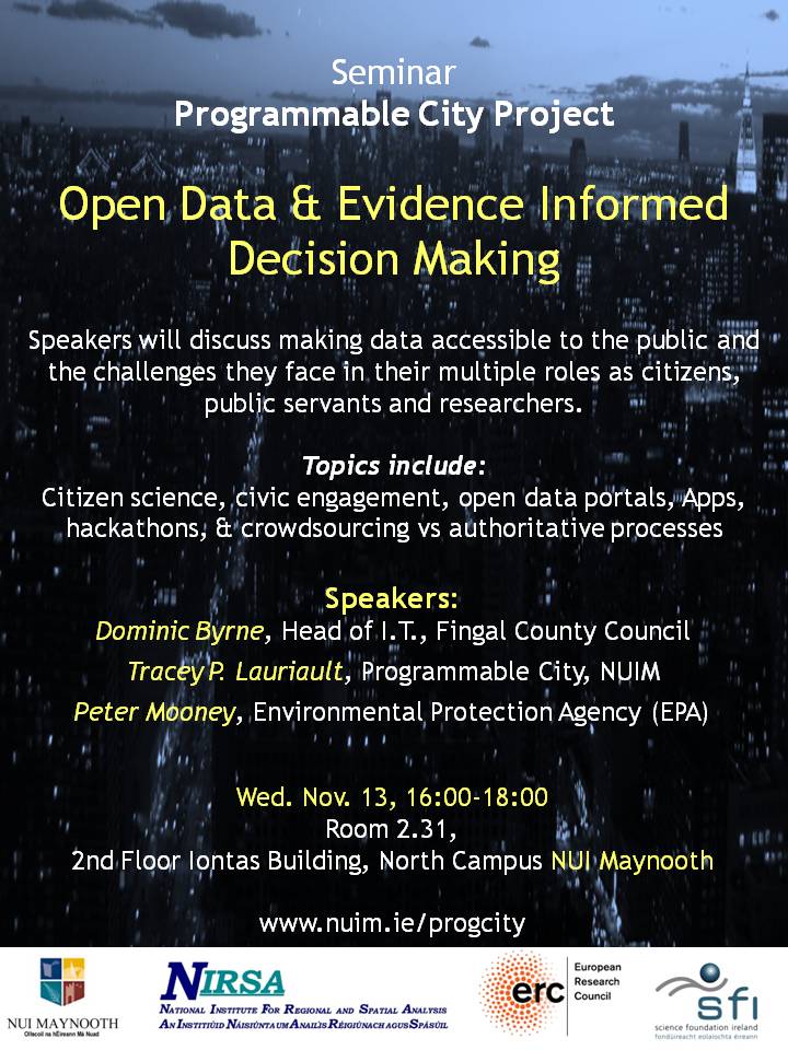
Seminar: Open data and evidence informed decision making

Wednesday, November 13, 16:00-18:00

Speakers will discuss making data accessible to the public and the challenges they face in their multiple roles as citizens, public servants and researchers.

Topics include:  Citizen science, civic engagement, open data portals, Apps, hackathons, & crowdsourcing vs authoritative processes

Speakers:

  • Dominic Byrne, Head of I.T., Fingal County Council
  • Tracey P. Lauriault, Programmable City, NUIM
  • Peter Mooney, Environmental Protection Agency (EPA)

Room 2.31, 2nd Floor Iontas Building, North Campus NUI Maynooth (Updated Map)

ProgCitySeminar1-poster-FINAL